our applied research
Projects of RSA FG
Spatial Energy Planning
Spatial energy planning, has the potential to become a game-changer and becomes an important lever for the integration of innovative & sustainable heating technologies.

aWHEREness:lab
Social being determines consciousness in dialectical materialism. "aWHEREness:lab" thus translates: The place also determines the (conscious) being.
Energy City Concepts
In this project new methodological approaches are developed and tested on the basis of two concrete model regions.

Enerspired Cities
Enerspired Cities - implementing the decarbonisation of the existing energy system is becoming increasingly important. There are many ways to achieve this.


Projekt ASSIST 4.0
Industry 4.0 is increasingly becoming the collective term for the new wave of digitisation, which is revolutionising the production of tangible goods in particular and has an enormous impact on the competitive position of companies.

Ocean Maps
The goal of OMG3D-Maps is to provide a cost-effective way to obtain, integrate and present high-resolution 3D underwater maps for B2B customers and divers.
Living finds city!
Mehrgeschossige urbane Wohnsiedlungen in offener Bauweise bergen viele Verbesserungs- und Nachverdichtungspotenziale in sich, welche häufig nicht genutzt werden.


SPAR Location Analysis App 2.0
Key project requirements for the SPAR App are flexible expandability of the components and integration of freely available software components.
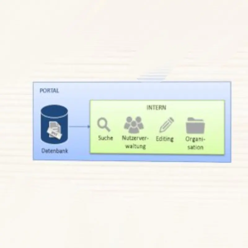
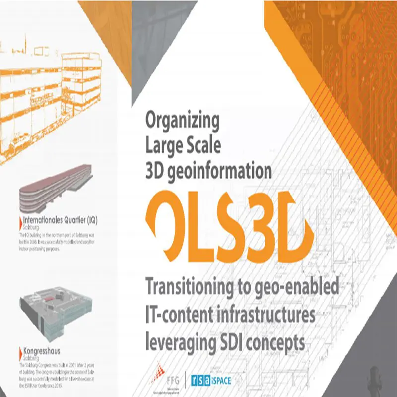
Spatial Information Infrastructure
Spatinal Information Infrastructure - Current organization of metadata in the as state of play analysis and then evaluated with the system solution.


WBL NV Potenziale Hallein
Residential land and redensification potentials in Hallein are development of GIS analysis models in coordination with the construction department / supervisory authorities.