The aim of the 5G-MOBiS project was to use 5G data for traffic control as well as spatial and mobility planning.
How many people are on the move, where and when – the collection of such information with the help of mobile phone data gained notoriety during Covid lockdown times. But it can be useful for much more, for example for analyzing commuter flows as a basis for creating new mobility services. In the 5G-MOBiS research project, the RSA FG’s iSPACE Research Studio investigated how 5G data can be used for traffic control and spatial and mobility planning.
At the end of the project, iSPACE researcher Florian Schöpflin presented the project and selected results at a webinar by project partner Invenium Data Insights on the potential of the 5G network. When it comes to analyzing commuter movements, it has so far been necessary to rely primarily on static data, i.e. where people leave and where they arrive. However, dynamic data is needed to better anticipate traffic jams and other problems and to plan demand-oriented services within the framework of the environmental network. In other words, information on how many people are on the road and when, and ideally with what. The use of the 5G network can support this, because what everyone has with them is their cell phone, whether for listening to music, navigating or making phone calls. So why not use the aggregated and classified data that they generate through their use of the 5G network?
Using the added space-time value of the 5G network
The 5th generation of mobile communications promises higher data rates, high availability and also high energy efficiency – which opens up a multitude of new fields of application. 5G-MOBiS (5G Mobility Innovations Salzburg) is a research project based on the Salzburg 2025 science and innovation strategy and funded by the state of Salzburg, which is investigating how 5G data can be used for traffic control and spatial and mobility planning. Together with project partners ANDATA and Invenium, the iSPACE Research Studio of the RSA FG is laying the foundations for research into the potential and added value of 5G data.
Thanks to 5G, data points can be assigned more precisely in terms of space and time, and large volumes of data can be transmitted more quickly. The collection of 5G data therefore offers added value in traffic situation detection and traffic planning.
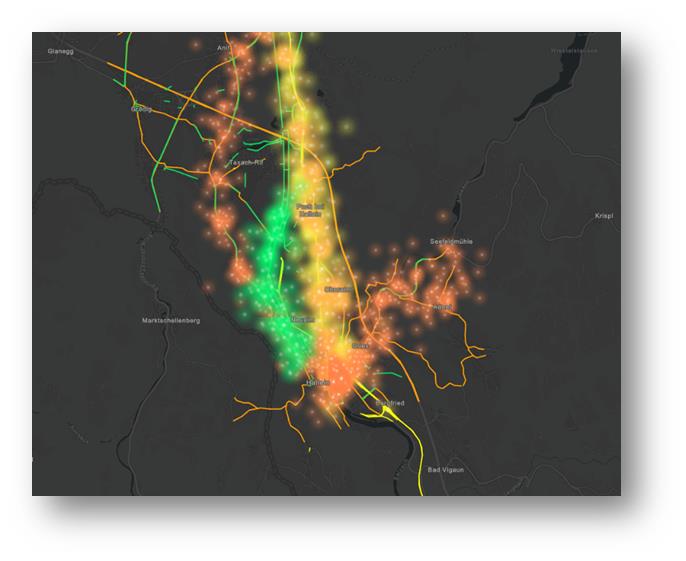
The applications developed were prototyped in a spatially limited regional lab in Hallein. Data protection turned out to be a limiting factor, as the researchers were not allowed to present the recorded data with real values if it had a value of less than 20 trips. Nevertheless, the advantages of the method were clear. This is because the allocation of less than 12 hours and less than 1,000 meters is already a major step forward compared to the otherwise static data.
Valuable results for further research
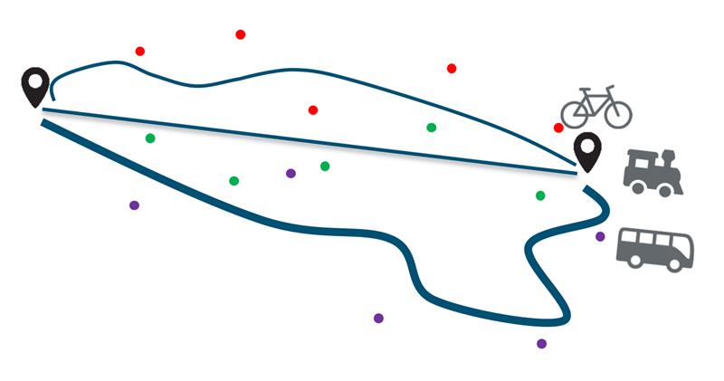
In the regional data laboratory in Hallein, the team also tried to find out whether they could also track the means of transportation used by cell phone users. To do this, they traveled by train, bus and bicycle with test devices. The idea behind this: On the one hand, the speed provides information, on the other hand the route, because if the cell phone generates data points along a rail network, the person is probably traveling by train. The most accurate way of determining the modes was to use the method developed for mobile phone trajectories recorded by bicycle and car.
The clear result of the project: 5G data can enhance existing GIS methods (Geographic Information Systems) and offer a clear advantage in demand-oriented mobility planning. Studio iSPACE will continue to build on the know-how gained in the 5G-MOBiS project in subsequent projects and further deepen its expertise with regard to spatio-temporal high-resolution data.
During the webinar, the other Invenium project partners Andata Labs and TU Graz also presented the results of the one-year research on 5G-Mobis and 5G-Libra.


