In this upcoming workshop, Research Studio iSPACE, together with SynerGIS, will present concepts for the preparation and visualization of geodata/digital 3D maps. You will also learn strategies for integrating the fourth, temporal dimension.
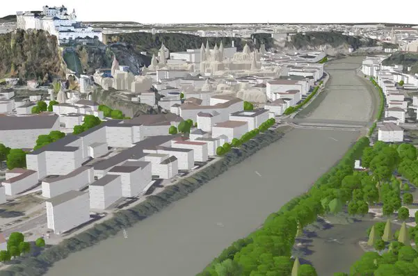
The general interest in multidimensional digital maps is increasing rapidly. There are more and more application areas for which, in addition to classic 2D digital maps, 3D and 4D digital mapping are of great interest. Using the results of the 4D-SDI research project as an example, the presenters will use digital basics and geodata from basemap.at to show what needs to be taken into account for the future processing of different 2D content (e.g. roads, bridges, buildings, bodies of water, labels) into a digital 3D base map. The necessary transfer strategies were largely designed and prototyped for ArcGIS Pro.
In addition to 3D, the integration of temporally dynamic content such as located sensor data is also becoming more important. In the webinar, we will show how located IoT data streams (e.g., temperature, humidity, etc.) and other publicly available live data streams (e.g., traffic data) together with 3D base maps and Building Information Modeling (BIM) data can be further developed into live 4D digital images (digital twins) of our environment.
Location: Webinar via Microsoft Teams, access is also possible without teams via internet browser
Start: Thursday 15. April 2021, 16:00 ; Duration: 60 Minutes.
Participation: Participation is free of charge.
Registration via the registration form is required, the link to the webinar will be announced via email before the event starts.
Presenter: Manfred Mittlböck, Caroline Atzl (both Research Studios Austria Forschungsgesellschaft – Studio iSPACE) and Stefan Jaquemar (SynerGIS)