Get the latest info on…
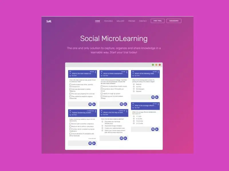
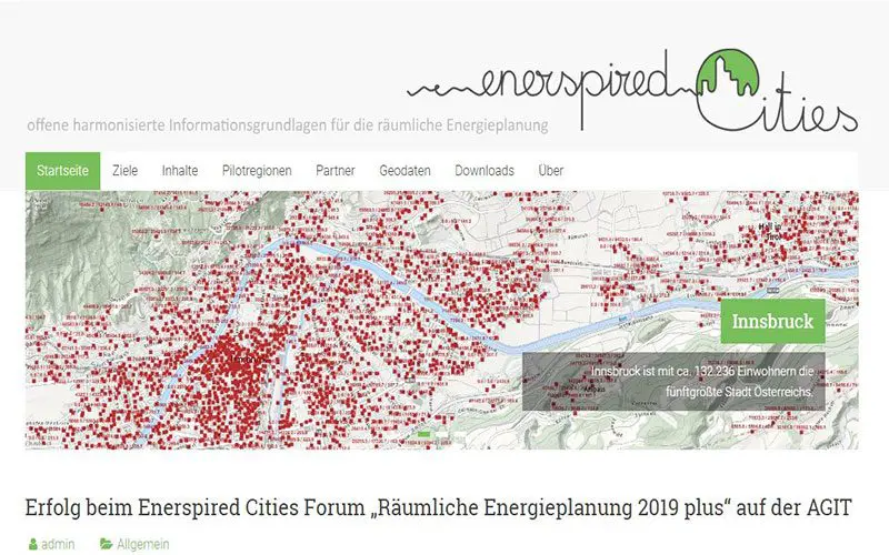
Working with Big Data
Zahlen und Fakten, Prototypen und Visionen, nationale Erfolgsgeschichten und internationale Pioniere des Handels mit Daten an einem Nachmittag in nur sechs Stunden.
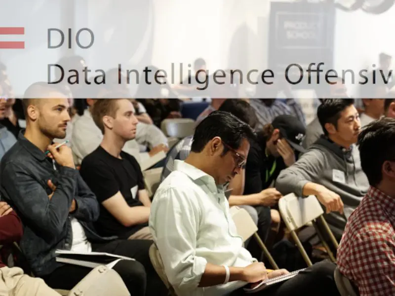
Second DIO stakeholder meeting
After the successful DIO stakeholder meeting in Graz on 10 April 2019 with about 20 participants from science, business and administration, the second conference is now taking place.
How to Make Profit With Data
Zum Höhepunkt des dreijährigen Leitprojekts "Data Market Austria" findet am Mittwoch, den 18. September 2019 im Festsaal des BMVIT eine Highlight-Konferenz statt.
Assistance system for pilot training
The safety of aircraft depends largely on the focused attention of pilots the reason why PCA develops with Lufthansa Aviation Training an assistance system for pilot training.
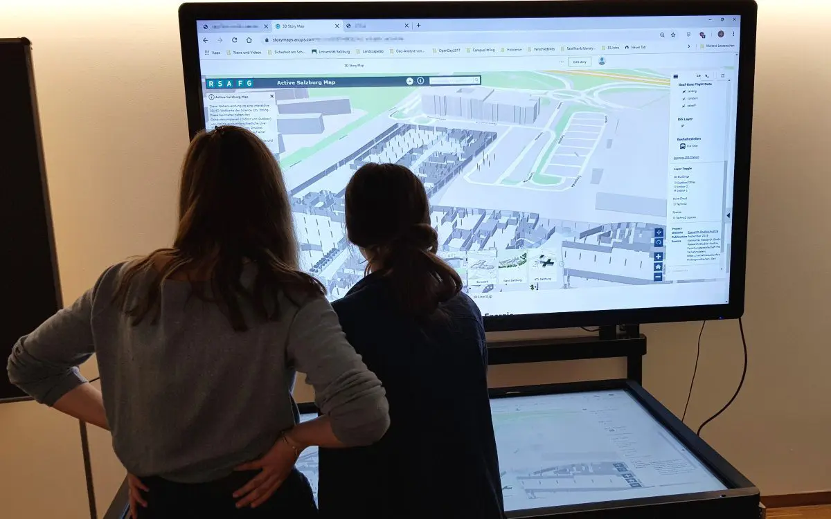
Green cities
The three-year "Urban Green Belts" project, in which Studio iSPACE was one of the partners, ended with a closing event.
RSA FG researcher at AI conference in Salzburg
Our studio manager Dr. Mihai Lupu and the scientific director of the RSA FG, Prof. DDr. Peter A. Bruck, presented two current joint projects of the RSA FG.
2019 EDC “Student of the Year” Award für Florian Schöpflin
As an ESRI Development Center, Z_GIS has the opportunity every year to nominate a top student for his or her competence in spatial development.
Centre for Alpine Construction with new image video
The Center of Alpine Construction, newly founded by FH Salzburg and Research Studio iSPACE 2018, will be a guest at the "Salzburg Science and Innovation Meeting".
“Data Market Austria” on tour
Das vom Research Studio Data Science gemanagte Leitprojekt des BMVIT, "Data Market Austria", "tourt" die nächsten Wochen durch Österreich
Research for “Ocean Maps”
Ocean Maps GmbH has just commissioned the research studio iSPACE with a new project, scheduled to run for one year, which involves digital images of hydroelectric power plants.
iSPACE for legal informatics
First results from the Enerspired Cities FFG project at IRIS 2019 (International Legal Informatics Symposium IRIS 2019, Salzburg).
Communication tool: “Spoco”
"Spoco" - the latest group communication tool developed by the research studios MoKnowLab and SAT of the RSA FG.
Competence-based Training & Assessment in Arts
Research Studio Pervasive Computing Applications (PCA) of the RSA FG investigates the interaction of musicians with their instruments using innovative technologies such as eye tracking.
Better living and working with BONUS and the Smart Cities Initiative
The Research Studio iSPACE Smart Settlement Systems presented its "BONUS" project at the meeting – and explained how it can be harnessed to make use of existing buildings and strengthen the environment at the same time.
Sustainable Mobility
Innovative sustainable mobility solutions are being tested in pilot regions as part of the ULTIMOB project – for Salzburg, the Research Studio iSPACE analysed commuter flows with the Salzburger Verkehrsverbund.
SEMANTiCS 2018
RSA-FG scientists in cooperation with Austrosoft have developed an innovative taxi order logistics on the web, including "Taxi Bot".
Geoinformaticians from Twente (NL) visiting
In the course of their excursion to various geoinformatics organizations in Germany and Austria 50 master students of geoinformatics visited the studio iSPACE.
GIS-Day 2019
As part of GIS-Day 2019 on November 13, Research Studio iSPACE introduced students in Salzburg and Linz to the current topic of energy saving in the context of global warming.
Research Studio iSPACE Successful launch event of the ULTIMOB personal mobility project
With more than 70 participants, the big regional kick-off event for the lead project ULTIMOB took place last November 14, 2019 in Salzburg.
Bots help with needs
During a hackathon at the TU Vienna, 14 new bot solutions were created within the framework of the Web of Needs, co-organized by the Research Studio SAT of the RSA FG.
GIS and buildings: Doctoral cap for iSPACE researcher Laura Knoth!
Doctoral thesis for iSPACE researcher Laura Knoth on extending geospatial analysis with BIM (Building Information Models).


